Geolocate

Punta Gnifetti topographic map

Click on the map to display elevation.

About this map

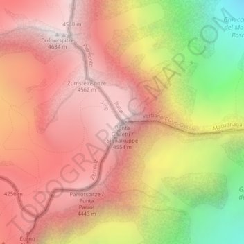
Name: Punta Gnifetti topographic map, elevation, terrain.

Location: Punta Gnifetti, Macugnaga, Verbano-Cusio-Ossola, Piemonte, Italia (45.92716 7.87703 45.92726 7.87713)

Average elevation: 3,872 m

Minimum elevation: 2,648 m

Maximum elevation: 4,619 m

Other topographic maps

Click on a map to view its topography, its elevation and its terrain.

Gear up for your next adventure:

🧤Insulated Winter Gloves - Heavy-duty protection for sub-zero Canadian adventures
🧦Crew Hiking Socks - Comfortable socks for long-distance hikes
Backpacking Tent - Lightweight tent for long-distance hiking trips
🥾Hiking Leggings - Comfortable leggings for outdoor activities
🥾Approach Shoes - Shoes designed for climbing approaches and rugged trails

As an Amazon Associate, this site earns from qualifying purchases at no extra cost to you.