Geolocate

Myers Lake topographic map

Click on the map to display elevation.

About this map

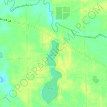
Name: Myers Lake topographic map, elevation, terrain.

Location: Myers Lake, Genesee County, Michigan, United States (42.80127 -83.88803 42.80787 -83.88383)

Average elevation: 262 m

Minimum elevation: 250 m

Maximum elevation: 271 m

Other topographic maps

Click on a map to view its topography, its elevation and its terrain.

Gear up for your next adventure:

🥾Mountain Hiking Shoes - Shoes with superior grip for mountainous terrain
Backpacking Tent - Lightweight tent for long-distance hiking trips
💧Reusable Water Bottle - Durable water bottles for hydration on trails
🛁Quick-Dry Microfiber Towel - Space-saving towel that dries rapidly on the move
🔦LED Flashlight - Powerful and long-lasting flashlight for camping and emergencies

As an Amazon Associate, this site earns from qualifying purchases at no extra cost to you.