Geolocate

Pingalay topographic map

Click on the map to display elevation.

About this map

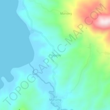
Name: Pingalay topographic map, elevation, terrain.

Location: Pingalay, Zamboanga del Sur, Zamboanga Peninsula, Philippines (7.67033 123.13330 7.71033 123.17330)

Average elevation: 105 m

Minimum elevation: -1 m

Maximum elevation: 494 m

Other topographic maps

Click on a map to view its topography, its elevation and its terrain.

Sominot

Philippines > Zamboanga del Sur

Average elevation: 261 m

Midsalip

Philippines > Zamboanga del Sur

Average elevation: 363 m

Midsalip

Philippines > Zamboanga del Sur

Average elevation: 363 m

Gear up for your next adventure:

👟Sport Hiking Sandals - Breathable footwear for water crossings and camp rest
🥾Hiking Leggings - Comfortable leggings for outdoor activities
🔭Compact Binoculars - Lightweight optics for scouting trails and wildlife
🪑Insulated Seat Pad - Protect your seat from cold rocks and wet logs
🧊Insulated Water Bottle - Keeps drinks cold in summer and prevents freezing in winter

As an Amazon Associate, this site earns from qualifying purchases at no extra cost to you.