
Thank you for supporting this site ❤️
Make a donation
Make a donation
Gear up for your next adventure:
As an Amazon Associate, this site earns from qualifying purchases at no extra cost to you.
Sillagoto topographic map
Click on the map to display elevation.
Thank you for supporting this site ❤️
Make a donation
Make a donation
Gear up for your next adventure:
As an Amazon Associate, this site earns from qualifying purchases at no extra cost to you.
About this map
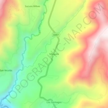
Name: Sillagoto topographic map, elevation, terrain.
Location: Sillagoto, Pallatanga, Chimborazo, Ecuador (-2.08346 -79.00557 -2.04346 -78.96557)
Average elevation: 1,384 m
Minimum elevation: 882 m
Maximum elevation: 1,950 m
Thank you for supporting this site ❤️
Make a donation
Make a donation
Gear up for your next adventure:
As an Amazon Associate, this site earns from qualifying purchases at no extra cost to you.