Geolocate

Zapatoca topographic map

Click on the map to display elevation.

Zapatoca

Altitud de la cabecera municipal (metros sobre el nivel del mar): 1720 msnm

About this map

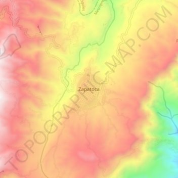
Name: Zapatoca topographic map, elevation, terrain.

Location: Zapatoca, Metropolitana, Santander, 604069, Colombia (6.77669 -73.30872 6.85669 -73.22872)

Average elevation: 1,707 m

Minimum elevation: 737 m

Maximum elevation: 2,364 m

Gear up for your next adventure:

💡Portable Camping Lamp - Rechargeable lamp for campsite lighting
👟Trail Running Shoes - Agile footwear for fast-paced topographic exploration
👟Sport Hiking Sandals - Breathable footwear for water crossings and camp rest
🧦Hiking Liner Socks - Thin base layer to prevent friction and blisters
🥾Approach Boots - Comfortable boots for hiking and climbing approaches

As an Amazon Associate, this site earns from qualifying purchases at no extra cost to you.