Geolocate

Pulian topographic map

Click on the map to display elevation.

About this map

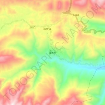
Name: Pulian topographic map, elevation, terrain.

Location: Pulian, Wuxi County, 渝东北三峡库区城镇群区位, Chongqing, China (31.26043 109.52272 31.34043 109.60272)

Average elevation: 793 m

Minimum elevation: 232 m

Maximum elevation: 1,391 m

Gear up for your next adventure:

🧢Outdoor Visor - Breathable visor for sunny hikes
🥾Hiking Shorts - Breathable shorts suitable for summer hikes
💧Hydration Pack - Hands-free hydration system for long hikes
🧴Sunscreen SPF - Broad-spectrum sunscreen for outdoor activities
👟Trail Running Shoes - Agile footwear for fast-paced topographic exploration

As an Amazon Associate, this site earns from qualifying purchases at no extra cost to you.