Geolocate

Mandeni topographic map

Click on the map to display elevation.

About this map

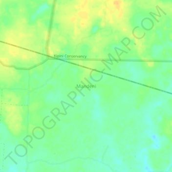
Name: Mandeni topographic map, elevation, terrain.

Location: Mandeni, Tana River County, Coastal Kenya, Kenya (-2.45330 40.51330 -2.41330 40.55330)

Average elevation: 20 m

Minimum elevation: 7 m

Maximum elevation: 34 m

Gear up for your next adventure:

🛌Down Sleeping Bag - Superior warmth-to-weight ratio for cold nights
🥾Lightweight Hiking Boots - Boots for comfort and mobility on long hikes
🧭GPS Tracker - Track your location in remote areas safely
🔭Compact Monocular - One-handed bird watching and trail spotting
Camping Coffee Maker - Brew fresh coffee anywhere on the topographic map

As an Amazon Associate, this site earns from qualifying purchases at no extra cost to you.