Geolocate

Mudelos topographic map

Click on the map to display elevation.

About this map

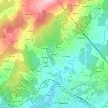
Name: Mudelos topographic map, elevation, terrain.

Location: Mudelos, O Carballiño, Orense, Galicia, 32534, España (42.42819 -8.10190 42.46819 -8.06190)

Average elevation: 464 m

Minimum elevation: 366 m

Maximum elevation: 639 m

Gear up for your next adventure:

🦯Trekking Poles - Reduced impact on joints for steep topographic climbs
🚲Bike Repair Kit - Essential tools for on-trail mechanical issues
🛶Kayak Dry Bag - Waterproof storage for kayaking adventures
🥾Trekking Poles - Adjustable trekking poles to reduce knee stress and improve stability
🔭Compact Binoculars - Lightweight optics for scouting trails and wildlife

As an Amazon Associate, this site earns from qualifying purchases at no extra cost to you.