Geolocate

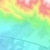
Rudehen topographic map

Click on the map to display elevation.

About this map

Name: Rudehen topographic map, elevation, terrain.

Location: Rudehen, Rudehen District, Damavand County, Tehran Province, 39731-88981, Iran (35.68726 51.88689 35.75297 51.96359)

Average elevation: 1,797 m

Minimum elevation: 1,533 m

Maximum elevation: 2,187 m

Other topographic maps

Click on a map to view its topography, its elevation and its terrain.

ولیران

Iran > Tehran Province > Damavand County > Damavand

Average elevation: 1,976 m

Gear up for your next adventure:

🥾All-Terrain Hiking Boots - Versatile boots for varied hiking conditions
🧤Rechargeable Heated Gloves - Extreme warmth for Canadian winter expeditions
🧥Waterproof Jacket - Lightweight rain jackets for hiking and outdoor activities
🔭Outdoor Binoculars - Lightweight binoculars for birdwatching and hiking
🔋Emergency Crank Radio - Weather alerts and power without needing batteries

As an Amazon Associate, this site earns from qualifying purchases at no extra cost to you.