Geolocate

Kg. Botol topographic map

Click on the map to display elevation.

About this map

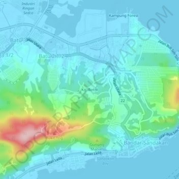
Name: Kg. Botol topographic map, elevation, terrain.

Location: Kg. Botol, Sandakan District, Sabah, 900000, Malaysia (5.83200 118.08589 5.87200 118.12589)

Average elevation: 36 m

Minimum elevation: -3 m

Maximum elevation: 217 m

Gear up for your next adventure:

🥾Waterproof Hiking Shoes - Durable shoes for wet and rugged trails
💡Compact LED Flashlight - Powerful and portable flashlight for outdoor use
Lightweight Camping Tent - Portable shelter optimized for Canadian backcountry camping
💧Reusable Water Bottle - Durable water bottles for hydration on trails
🦯Trekking Poles - Reduced impact on joints for steep topographic climbs

As an Amazon Associate, this site earns from qualifying purchases at no extra cost to you.