Geolocate

Lake Butler topographic map

Click on the map to display elevation.

About this map

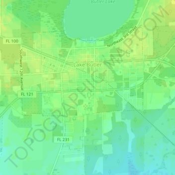
Name: Lake Butler topographic map, elevation, terrain.

Location: Lake Butler, Union County, Florida, United States (30.00739 -82.35494 30.02984 -82.31853)

Average elevation: 41 m

Minimum elevation: 32 m

Maximum elevation: 48 m

Other topographic maps

Click on a map to view its topography, its elevation and its terrain.

Providence

United States > Florida > Union County

Average elevation: 35 m

Gear up for your next adventure:

🧴Bear Spray Holster - Quick-access carry for essential Canadian wilderness safety
🛁Quick-Dry Microfiber Towel - Space-saving towel that dries rapidly on the move
🧥Waterproof Jacket - Lightweight rain jackets for hiking and outdoor activities
🦟Insect Repellent - Keep mosquitoes and black flies away in wooded areas
🧦Crew Hiking Socks - Comfortable socks for long-distance hikes

As an Amazon Associate, this site earns from qualifying purchases at no extra cost to you.