
Said Sadiq topographic map
Click on the map to display elevation.
About this map
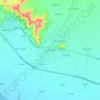
Name: Said Sadiq topographic map, elevation, terrain.
Average elevation: 524 m
Minimum elevation: 480 m
Maximum elevation: 794 m
Other topographic maps
Click on a map to view its topography, its elevation and its terrain.
Darbandikhan Dam
Iraq > Sulaymaniyah Governorate > Darbandikhan
The dam is located within a gorge on a foundation of sedimentary rocks. It is a rock-fill embankment type with a central clay core. The dam is 128 m (420 ft) tall and 445 m (1,460 ft) long (535 m (1,755 ft) if the spillway section is included). Its crest is 17 m (56 ft) wide and at an elevation of 495 m (1,624…
Average elevation: 571 m