
Кордова topographic map
Interactive map
Click on the map to display elevation.
About this map
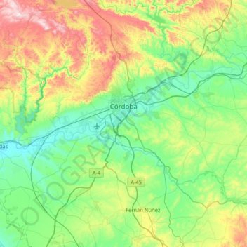
Name: Кордова topographic map, elevation, terrain.
Location: Кордова, Андалусия, Испания (37.66582 -4.99860 38.03152 -4.35143)
Average elevation: 281 m
Minimum elevation: 64 m
Maximum elevation: 878 m