Geolocate

Pointe d'Émy topographic map

Click on the map to display elevation.

About this map
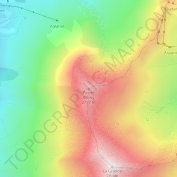
Name: Pointe d'Émy topographic map, elevation, terrain.

Location: Pointe d'Émy, Albiez-Montrond, Saint-Jean-de-Maurienne, Savoie, Auvergne-Rhône-Alpes, France métropolitaine, 73300, France (45.19265 6.36838 45.19275 6.36848)

Average elevation: 2,303 m

Minimum elevation: 1,775 m

Maximum elevation: 2,901 m

Other topographic maps

Click on a map to view its topography, its elevation and its terrain.
Montrond

France > Auvergne-Rhône-Alpes > Savoie > Albiez-Montrond

Average elevation: 2,048 m

Gear up for your next adventure:

🩹Compact First Aid Kit - Pre-packed essentials for common trail injuries
🚲Bike Repair Kit - Essential tools for on-trail mechanical issues
🔦LED Headtorch - Bright and durable light for night activities
🥾Hiking Shorts - Breathable shorts suitable for summer hikes
🧢Outdoor Visor - Breathable visor for sunny hikes

As an Amazon Associate, this site earns from qualifying purchases at no extra cost to you.