
Thank you for supporting this site ❤️
Make a donation
Make a donation
Gear up for your next adventure:
As an Amazon Associate, this site earns from qualifying purchases at no extra cost to you.
العامرية topographic map
Click on the map to display elevation.
Thank you for supporting this site ❤️
Make a donation
Make a donation
Gear up for your next adventure:
As an Amazon Associate, this site earns from qualifying purchases at no extra cost to you.
About this map
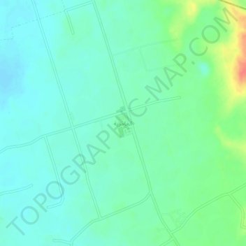
Name: العامرية topographic map, elevation, terrain.
Location: العامرية, Ad Duwadimi, Riyadh Region, Saudi Arabia (25.43245 44.18043 25.47245 44.22043)
Average elevation: 728 m
Minimum elevation: 714 m
Maximum elevation: 766 m
Thank you for supporting this site ❤️
Make a donation
Make a donation
Gear up for your next adventure:
As an Amazon Associate, this site earns from qualifying purchases at no extra cost to you.