Geolocate

Point topographic map

Click on the map to display elevation.

About this map

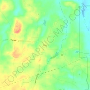
Name: Point topographic map, elevation, terrain.

Location: Point, Union Parish, Louisiana, United States (32.64098 -92.29796 32.68098 -92.25796)

Average elevation: 40 m

Minimum elevation: 15 m

Maximum elevation: 71 m

Other topographic maps

Click on a map to view its topography, its elevation and its terrain.

Downsville

United States > Louisiana > Union Parish

Average elevation: 68 m

Lillie

United States > Louisiana > Union Parish

Average elevation: 40 m

Downsville

United States > Louisiana > Union Parish

Average elevation: 68 m

Gear up for your next adventure:

🛶Kayak Dry Bag - Waterproof storage for kayaking adventures
🥘Camping Cookware Set - Compact nesting pots and pans for trail cooking
👟Sport Hiking Sandals - Breathable footwear for water crossings and camp rest
🥾Mountain Hiking Boots - High-traction boots for rocky terrain
🥾Mountain Hiking Shoes - Shoes with superior grip for mountainous terrain

As an Amazon Associate, this site earns from qualifying purchases at no extra cost to you.