Geolocate

Krepta topographic map

Click on the map to display elevation.

About this map

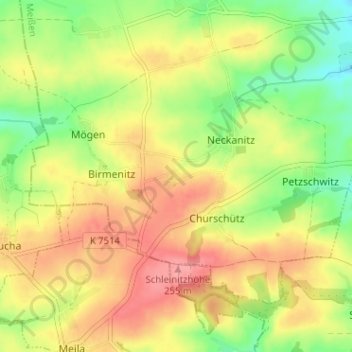
Name: Krepta topographic map, elevation, terrain.

Location: Krepta, Neckanitz, Lommatzsch, Meißen, Sachsen, Deutschland (51.15882 13.21756 51.19882 13.25756)

Average elevation: 214 m

Minimum elevation: 168 m

Maximum elevation: 257 m

Gear up for your next adventure:

🥾Durable Hiking Shoes - Long-lasting shoes for frequent hiking
🥾Mountaineering Boots - Supportive boots for climbing and high-altitude hiking
🧭Orienteering Kit - Tools for map reading and navigation in the wild
🥾Mountain Hiking Boots - High-traction boots for rocky terrain
🎒Hiking Daypack - Lightweight and durable backpacks for day trips and excursions

As an Amazon Associate, this site earns from qualifying purchases at no extra cost to you.