
Thank you for supporting this site ❤️
Make a donation
Make a donation
Gear up for your next adventure:
As an Amazon Associate, this site earns from qualifying purchases at no extra cost to you.
Udalka topographic map
Click on the map to display elevation.
Thank you for supporting this site ❤️
Make a donation
Make a donation
Gear up for your next adventure:
As an Amazon Associate, this site earns from qualifying purchases at no extra cost to you.
About this map
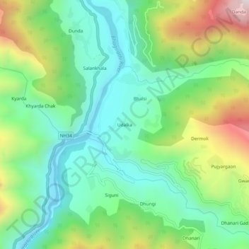
Name: Udalka topographic map, elevation, terrain.
Location: Udalka, Dunda, Uttarkashi district, Uttarakhand, Inde (30.66050 78.33743 30.70050 78.37743)
Average elevation: 1,204 m
Minimum elevation: 904 m
Maximum elevation: 1,826 m
Thank you for supporting this site ❤️
Make a donation
Make a donation
Gear up for your next adventure:
As an Amazon Associate, this site earns from qualifying purchases at no extra cost to you.