Geolocate

Jayuya topographic map

Click on the map to display elevation.

About this map

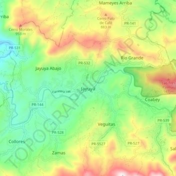
Name: Jayuya topographic map, elevation, terrain.

Location: Jayuya, Puerto Rico, 00664, United States (18.17887 -66.63237 18.25887 -66.55237)

Average elevation: 633 m

Minimum elevation: 270 m

Maximum elevation: 1,214 m

Gear up for your next adventure:

💧Collapsible Water Bottle - Space-saving water bottle for outdoor activities
🔦UV Flashlight - Detect minerals or specific insects in the dark
🥤Collapsible Travel Cup - Saves space and weight in your mess kit
🕯️Camping Lantern - Illuminates your entire campsite with high-efficiency LEDs
🚲Bike Repair Kit - Essential tools for on-trail mechanical issues

As an Amazon Associate, this site earns from qualifying purchases at no extra cost to you.