Geolocate

Aloños topographic map

Click on the map to display elevation.

Aloños

Aloños es una localidad del municipio de Villacarriedo (Cantabria, España). En el año 2008 contaba con una población de 165 habitantes (INE). La localidad se encuentra a 5 kilómetros al oeste de la capital municipal Villacarriedo, y está a una altitud de 305 msnm.

About this map

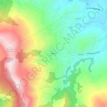
Name: Aloños topographic map, elevation, terrain.

Location: Aloños, Villacarriedo, Valles Pasiegos, Cantabria, 39649, España (43.20949 -3.89483 43.24949 -3.85483)

Average elevation: 441 m

Minimum elevation: 162 m

Maximum elevation: 848 m

Gear up for your next adventure:

❄️Traction Ice Cleats - Slip-on spikes for icy trails and winter hiking
🧥Ultralight Puffy Jacket - Maximum warmth that packs down to the size of an orange
🔋Solar Power Bank - Keep your GPS and devices charged during long outdoor trips
🔦UV Flashlight - Detect minerals or specific insects in the dark
🕶️Polarized Sunglasses - Reduces glare from snow and water at high elevations

As an Amazon Associate, this site earns from qualifying purchases at no extra cost to you.