Geolocate

Forest topographic map

Click on the map to display elevation.

About this map

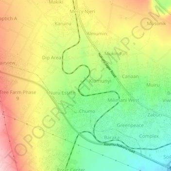
Name: Forest topographic map, elevation, terrain.

Location: Forest, Menengai West ward, Rongai, Nakuru, Kenya (-0.28013 35.98883 -0.24013 36.02883)

Average elevation: 1,996 m

Minimum elevation: 1,893 m

Maximum elevation: 2,110 m

Gear up for your next adventure:

🦶Hiking Shoe Insoles - Added support for high arches and long days on feet
🥾Mountain Hiking Boots - High-traction boots for rocky terrain
🥾Lightweight Hiking Boots - Boots for comfort and mobility on long hikes
🥘Camping Cookware Set - Compact nesting pots and pans for trail cooking
🛶Waterproof Dry Bags - Keep electronics and clothes dry during river crossings

As an Amazon Associate, this site earns from qualifying purchases at no extra cost to you.