
Thank you for supporting this site ❤️
Make a donation
Make a donation
Gear up for your next adventure:
As an Amazon Associate, this site earns from qualifying purchases at no extra cost to you.
Djemorah topographic map
Click on the map to display elevation.
Thank you for supporting this site ❤️
Make a donation
Make a donation
Gear up for your next adventure:
As an Amazon Associate, this site earns from qualifying purchases at no extra cost to you.
About this map
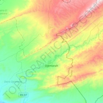
Name: Djemorah topographic map, elevation, terrain.
Location: Djemorah, Daïra Djemorah, Biskra, 07008, Algérie (35.02367 5.62457 35.17590 5.90276)
Average elevation: 793 m
Minimum elevation: 247 m
Maximum elevation: 1,773 m
Thank you for supporting this site ❤️
Make a donation
Make a donation
Gear up for your next adventure:
As an Amazon Associate, this site earns from qualifying purchases at no extra cost to you.