Geolocate

La Merced topographic map

Click on the map to display elevation.

About this map

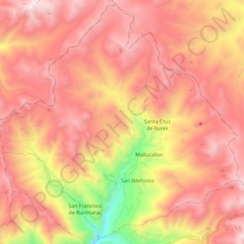
Name: La Merced topographic map, elevation, terrain.

Location: La Merced, Province of Aija, Ancash, Peru (-9.77419 -77.69861 -9.62083 -77.53880)

Average elevation: 4,166 m

Minimum elevation: 3,048 m

Maximum elevation: 4,858 m

Gear up for your next adventure:

🧤Insulated Winter Gloves - Heavy-duty protection for sub-zero Canadian adventures
🧊Insulated Water Bottle - Keeps drinks cold in summer and prevents freezing in winter
🧊Portable Cooler - Keep food and drinks cold during outdoor adventures
🥾Lightweight Hiking Boots - Boots for comfort and mobility on long hikes
🔭Outdoor Binoculars - Lightweight binoculars for birdwatching and hiking

As an Amazon Associate, this site earns from qualifying purchases at no extra cost to you.