Geolocate

Orellana topographic map

Click on the map to display elevation.

About this map

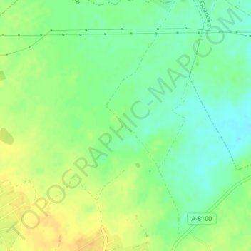
Name: Orellana topographic map, elevation, terrain.

Location: Orellana, Utrera, Sevilla, Andalucía, España (37.22656 -5.77967 37.24656 -5.75967)

Average elevation: 65 m

Minimum elevation: 52 m

Maximum elevation: 78 m

Gear up for your next adventure:

👟Trail Running Shoes - Agile footwear for fast-paced topographic exploration
🧦Crew Hiking Socks - Comfortable socks for long-distance hikes
🥾Mountain Hiking Shoes - Shoes with superior grip for mountainous terrain
🧥Softshell Hiking Jacket - The perfect balance of wind protection and breathability
🔦LED Headlamp - Hands-free lighting for early morning starts or late finishes

As an Amazon Associate, this site earns from qualifying purchases at no extra cost to you.