
Thank you for supporting this site ❤️
Make a donation
Make a donation
Gear up for your next adventure:
As an Amazon Associate, this site earns from qualifying purchases at no extra cost to you.
Tabbiano topographic map
Click on the map to display elevation.
Thank you for supporting this site ❤️
Make a donation
Make a donation
Gear up for your next adventure:
As an Amazon Associate, this site earns from qualifying purchases at no extra cost to you.
About this map
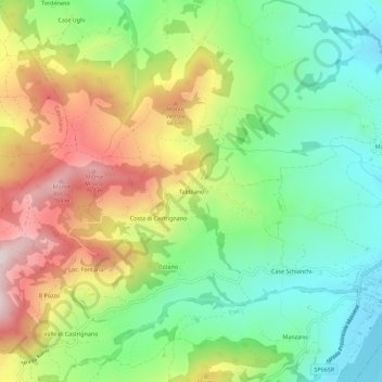
Name: Tabbiano topographic map, elevation, terrain.
Location: Tabbiano, Langhirano, Parma, Emilia-Romagna, 43013, Italia (44.59442 10.21070 44.63442 10.25070)
Average elevation: 484 m
Minimum elevation: 275 m
Maximum elevation: 794 m
Thank you for supporting this site ❤️
Make a donation
Make a donation
Gear up for your next adventure:
As an Amazon Associate, this site earns from qualifying purchases at no extra cost to you.