Geolocate

Las Damas topographic map

Click on the map to display elevation.

About this map

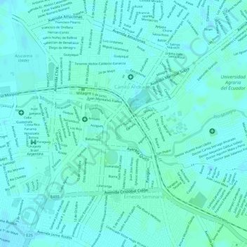
Name: Las Damas topographic map, elevation, terrain.

Location: Las Damas, Milagro, Guayas, 091703, Ecuador (-2.13170 -79.58882 -2.13160 -79.58872)

Average elevation: 13 m

Minimum elevation: 10 m

Maximum elevation: 16 m

Other topographic maps

Click on a map to view its topography, its elevation and its terrain.

Milagro

Ecuador > Guayas > Milagro

Average elevation: 14 m

Gear up for your next adventure:

🥾Trail Running Boots - Durable shoes designed for trail running
🥽Outdoor Goggles - Protective eyewear for outdoor activities
🪑Insulated Seat Pad - Protect your seat from cold rocks and wet logs
🥾Approach Shoes - Shoes designed for climbing approaches and rugged trails
🧦Merino Wool Socks - Moisture-wicking comfort for long-distance hiking

As an Amazon Associate, this site earns from qualifying purchases at no extra cost to you.