
Thank you for supporting this site ❤️
Make a donation
Make a donation
Gear up for your next adventure:
As an Amazon Associate, this site earns from qualifying purchases at no extra cost to you.
Söğütlü topographic map
Click on the map to display elevation.
Thank you for supporting this site ❤️
Make a donation
Make a donation
Gear up for your next adventure:
As an Amazon Associate, this site earns from qualifying purchases at no extra cost to you.
About this map
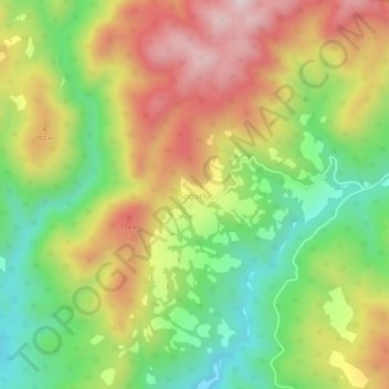
Name: Söğütlü topographic map, elevation, terrain.
Location: Söğütlü, Akhisar, Manisa, Aegean Region, Turkey (39.14797 27.99136 39.18797 28.03136)
Average elevation: 596 m
Minimum elevation: 332 m
Maximum elevation: 899 m
Thank you for supporting this site ❤️
Make a donation
Make a donation
Gear up for your next adventure:
As an Amazon Associate, this site earns from qualifying purchases at no extra cost to you.