Geolocate

Les topographic map

Click on the map to display elevation.

About this map

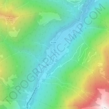
Name: Les topographic map, elevation, terrain.

Location: Les, Val d'Aran, Lleida, Catalonia, 25540, Spain (42.79269 0.69183 42.83269 0.73183)

Average elevation: 1,090 m

Minimum elevation: 605 m

Maximum elevation: 2,239 m

Gear up for your next adventure:

🧤Rechargeable Heated Gloves - Extreme warmth for Canadian winter expeditions
🧰Emergency Multi-Tool - Compact multi-tool for outdoor survival
🔭Compact Binoculars - Lightweight optics for scouting trails and wildlife
🧊Insulated Water Bottle - Keeps drinks cold in summer and prevents freezing in winter
🕯️Camping Lantern - Illuminates your entire campsite with high-efficiency LEDs

As an Amazon Associate, this site earns from qualifying purchases at no extra cost to you.