Geolocate

Soweto topographic map

Click on the map to display elevation.

About this map

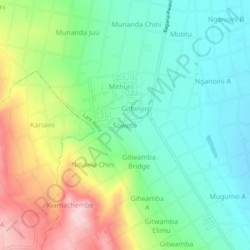
Name: Soweto topographic map, elevation, terrain.

Location: Soweto, Lare ward, Njoro, Nakuru, Kenya (-0.46793 35.99062 -0.42793 36.03062)

Average elevation: 2,117 m

Minimum elevation: 2,028 m

Maximum elevation: 2,287 m

Gear up for your next adventure:

🧭GPS Outdoor Watch - Smart watch for navigation and fitness tracking in nature
🧰Emergency Multi-Tool - Compact multi-tool for outdoor survival
🦟Insect Repellent - Keep mosquitoes and black flies away in wooded areas
🧴Waterproofing Spray - Restore the DWR coating on jackets and tents
🦌Outdoor Trail Camera - Monitor wildlife activity near your favorite spots

As an Amazon Associate, this site earns from qualifying purchases at no extra cost to you.