Geolocate

Caserio topographic map

Click on the map to display elevation.

About this map

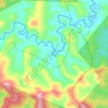
Name: Caserio topographic map, elevation, terrain.

Location: Caserio, Quibdó, Chocó, RAP Pacífico, Colombia (5.93184 -76.95860 5.97184 -76.91860)

Average elevation: 130 m

Minimum elevation: 38 m

Maximum elevation: 286 m

Gear up for your next adventure:

🚲MTB Frame Bag - Carry tools and maps directly on your bicycle frame
🦯Trekking Poles - Reduced impact on joints for steep topographic climbs
🪑Insulated Seat Pad - Protect your seat from cold rocks and wet logs
💡Portable Camping Lamp - Rechargeable lamp for campsite lighting
🧣Merino Neck Gaiter - Protects against wind, sun, and cold at high altitudes

As an Amazon Associate, this site earns from qualifying purchases at no extra cost to you.