
Make a donation
Gear up for your next adventure:
As an Amazon Associate, this site earns from qualifying purchases at no extra cost to you.
Santa Ana del Yacuma topographic map
Click on the map to display elevation.
Make a donation
Gear up for your next adventure:
As an Amazon Associate, this site earns from qualifying purchases at no extra cost to you.
Santa Ana del Yacuma
Santa Ana is the capital of the Yacuma Province and the Santa Ana del Yacuma Municipality, located at an elevation of 144 m above sea level, where the Yacuma River meets the Mamoré River. Santa Ana is located 150 Kilometer north-west of Trinidad, the department's capital. The city has an Airport, the Santa Ana del Yacuma Airport, which is located just outside the city.
Make a donation
Gear up for your next adventure:
As an Amazon Associate, this site earns from qualifying purchases at no extra cost to you.
About this map
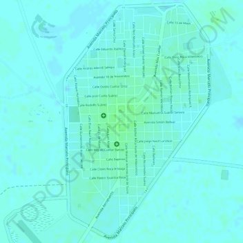
Name: Santa Ana del Yacuma topographic map, elevation, terrain.
Average elevation: 142 m
Minimum elevation: 139 m
Maximum elevation: 146 m
Make a donation
Gear up for your next adventure:
As an Amazon Associate, this site earns from qualifying purchases at no extra cost to you.