Geolocate

Harpers Ferry topographic map

Click on the map to display elevation.

About this map

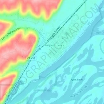
Name: Harpers Ferry topographic map, elevation, terrain.

Location: Harpers Ferry, Allamakee County, Iowa, United States (43.18901 -91.16364 43.20858 -91.13867)

Average elevation: 214 m

Minimum elevation: 182 m

Maximum elevation: 311 m

Gear up for your next adventure:

🥽Outdoor Goggles - Protective eyewear for outdoor activities
🧤Thermal Hiking Gloves - Grip-enhanced gloves for cold-weather altitude trekking
🌡️Emergency Mylar Blankets - Compact thermal protection for unexpected nights outdoors
🥾Lightweight Hiking Shoes - Comfortable shoes for day hikes
🥾Hiking Leggings - Comfortable leggings for outdoor activities

As an Amazon Associate, this site earns from qualifying purchases at no extra cost to you.