Geolocate

McGregor topographic map

Click on the map to display elevation.

About this map

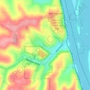
Name: McGregor topographic map, elevation, terrain.

Location: McGregor, Clayton County, Iowa, United States (43.01239 -91.20072 43.03634 -91.16818)

Average elevation: 249 m

Minimum elevation: 185 m

Maximum elevation: 333 m

Gear up for your next adventure:

🥾Trail Hiking Socks - Comfortable socks to prevent blisters and fatigue
🥾Hiking Shoes - Durable and comfortable shoes for trail hiking
🧥Waterproof Hiking Jacket - Protect yourself from rain and wind while hiking
Lightweight Camping Tent - Portable shelter optimized for Canadian backcountry camping
🧭GPS Outdoor Watch - Smart watch for navigation and fitness tracking in nature

As an Amazon Associate, this site earns from qualifying purchases at no extra cost to you.