Geolocate

Derroñadas topographic map

Click on the map to display elevation.

About this map

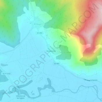
Name: Derroñadas topographic map, elevation, terrain.

Location: Derroñadas, El Royo, Soria, Castilla y León, España (41.87740 -2.65751 41.91740 -2.61751)

Average elevation: 1,120 m

Minimum elevation: 1,032 m

Maximum elevation: 1,443 m

Gear up for your next adventure:

🥾Mountain Hiking Boots - High-traction boots for rocky terrain
👖Convertible Hiking Pants - Zip-off legs to adapt to changing weather conditions
Camping Coffee Maker - Brew fresh coffee anywhere on the topographic map
🦟Insect Repellent - Keep mosquitoes and black flies away in wooded areas
🕯️Camping Lantern - Illuminates your entire campsite with high-efficiency LEDs

As an Amazon Associate, this site earns from qualifying purchases at no extra cost to you.