Geolocate

Sentmenat topographic map

Click on the map to display elevation.

About this map

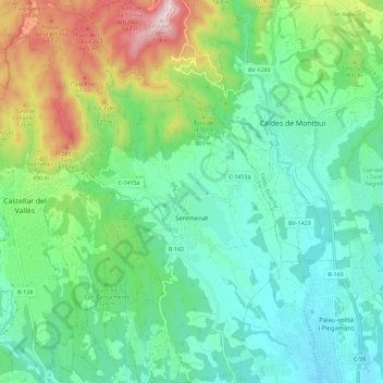
Name: Sentmenat topographic map, elevation, terrain.

Location: Sentmenat, Vallès Occidental, Barcelona, Catalonia, 08181, Spain (41.57408 2.09087 41.65959 2.16426)

Average elevation: 301 m

Minimum elevation: 109 m

Maximum elevation: 799 m

Other topographic maps

Click on a map to view its topography, its elevation and its terrain.

Sabadell

Spain > Catalonia > Vallès Occidental > Sabadell

Average elevation: 244 m

Gear up for your next adventure:

🛏️Camping Sleeping Mat - Comfortable mats for sleeping outdoors
🧥Waterproof Pants - Keep dry during rainy hiking conditions
🌬️Windproof Camp Stove - Efficient cooking even on exposed mountain peaks
🥾Light Hiking Boots - Lightweight and comfortable boots for day hikes
Tent Footprint - Protect tent floor and increase durability

As an Amazon Associate, this site earns from qualifying purchases at no extra cost to you.