
Westenbrügge topographic map
Interactive map
Click on the map to display elevation.
About this map
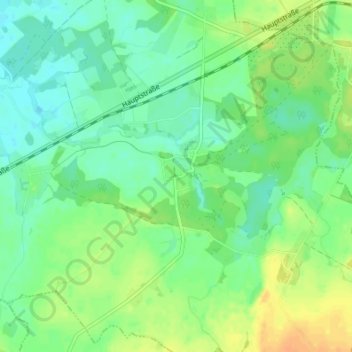
Name: Westenbrügge topographic map, elevation, terrain.
Average elevation: 30 m
Minimum elevation: 18 m
Maximum elevation: 47 m
Other topographic maps
Click on a map to view its topography, its elevation and its terrain.
Wischuer
Deutschland > Mecklenburg-Vorpommern > Landkreis Rostock > Biendorf
Wischuer, Biendorf, Neubukow-Salzhaff, Landkreis Rostock, Mecklenburg-Vorpommern, 18230, Deutschland
Average elevation: 51 m
Berghausen
Deutschland > Mecklenburg-Vorpommern > Landkreis Rostock > Biendorf
Berghausen, Biendorf, Neubukow-Salzhaff, Landkreis Rostock, Mecklenburg-Vorpommern, 18233, Deutschland
Average elevation: 27 m