Geolocate

Bessungen topographic map

Click on the map to display elevation.

About this map
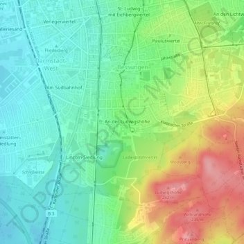
Name: Bessungen topographic map, elevation, terrain.

Location: Bessungen, Darmstadt, Hesse, 64285, Germany (49.83573 8.63805 49.86751 8.68382)

Average elevation: 170 m

Minimum elevation: 124 m

Maximum elevation: 249 m

Other topographic maps

Click on a map to view its topography, its elevation and its terrain.

Akaziengarten

Germany > Hesse > Darmstadt

Average elevation: 140 m

Gear up for your next adventure:

🧤Rechargeable Heated Gloves - Extreme warmth for Canadian winter expeditions
🥾Light Trekking Boots - Supportive boots for multi-day treks
🎒Hiking Daypack - Lightweight and durable backpacks for day trips and excursions
🎒Hiking Backpack - Lightweight and ergonomic backpacks for day hikes or multi-day treks
⛺Camping Essentials - All-in-one gear for a comfortable camping trip

As an Amazon Associate, this site earns from qualifying purchases at no extra cost to you.