Geolocate

Djaafri topographic map

Click on the map to display elevation.

About this map
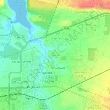
Name: Djaafri topographic map, elevation, terrain.

Location: Djaafri, Reghaia, Rouiba District, Algiers, 16000, Algeria (36.73042 3.33240 36.77042 3.37240)

Average elevation: 23 m

Minimum elevation: -4 m

Maximum elevation: 59 m

Gear up for your next adventure:

🧦Thermal Socks - Warm socks for winter hiking or camping
💧Hydration Pack - Hands-free hydration system for long hikes
🎒Hiking Backpack - Lightweight and ergonomic backpacks for day hikes or multi-day treks
🛶Kayak Dry Bag - Waterproof storage for kayaking adventures
🔦UV Flashlight - Detect minerals or specific insects in the dark

As an Amazon Associate, this site earns from qualifying purchases at no extra cost to you.