Geolocate

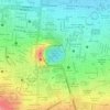
Distrito IV topographic map

Click on the map to display elevation.

About this map

Name: Distrito IV topographic map, elevation, terrain.

Location: Distrito IV, Managua, Nicaragua (12.13036 -86.26493 12.16629 -86.22266)

Average elevation: 72 m

Minimum elevation: 38 m

Maximum elevation: 128 m

Other topographic maps

Click on a map to view its topography, its elevation and its terrain.
Laguna de Tiscapa

Nicaragua > Managua > Managua

Average elevation: 90 m

Gear up for your next adventure:

🧥Ultralight Puffy Jacket - Maximum warmth that packs down to the size of an orange
🧳Compression Sacks - Maximize space in your backpack by shrinking gear
🛶Kayak Dry Bag - Waterproof storage for kayaking adventures
🧊Insulated Water Bottle - Keeps drinks cold in summer and prevents freezing in winter
🍽️Titanium Camping Spork - Ultralight and indestructible eating utensil

As an Amazon Associate, this site earns from qualifying purchases at no extra cost to you.