Geolocate

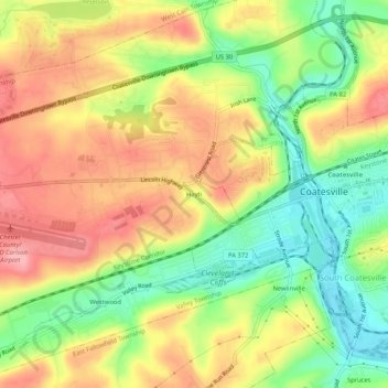
Hayti topographic map

Click on the map to display elevation.

Hayti

Hayti is a census designated place and unincorporated community situated in Valley Township in Chester County, Pennsylvania, United States. The CDP was first designated as such in 2020. As of 2020, it has a population of 2,890. Hayti has an estimated elevation of 502 feet (153 m) above sea level.

Wikipedia (CC-BY-SA 3.0)

About this map

Name: Hayti topographic map, elevation, terrain.

Location: Hayti, Valley Township, Chester County, Pennsylvania, 13920, United States (39.96288 -75.86134 40.00288 -75.82134)

Average elevation: 151 m

Minimum elevation: 88 m

Maximum elevation: 210 m

Gear up for your next adventure:

🧥Waterproof Jacket - Lightweight rain jackets for hiking and outdoor activities
🧰Survival Kit - Essential gear for emergencies in the wilderness
🧢Hiking Hat - Sun-protective and breathable hats for long treks
🧢Sun Protection Cap - Breathable cap to protect from sun exposure
🥾Waterproof Trail Shoes - Shoes designed to handle wet terrain

As an Amazon Associate, this site earns from qualifying purchases at no extra cost to you.