
Thank you for supporting this site ❤️
Make a donation
Make a donation
Gear up for your next adventure:
As an Amazon Associate, this site earns from qualifying purchases at no extra cost to you.
Amrabad topographic map
Click on the map to display elevation.
Thank you for supporting this site ❤️
Make a donation
Make a donation
Gear up for your next adventure:
As an Amazon Associate, this site earns from qualifying purchases at no extra cost to you.
About this map
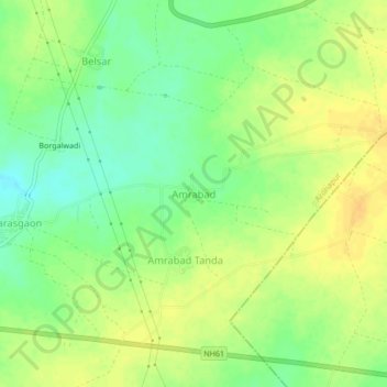
Name: Amrabad topographic map, elevation, terrain.
Location: Amrabad, Ardhapur, Nanded, Maharashtra, 431745, India (19.22636 77.40076 19.26636 77.44076)
Average elevation: 374 m
Minimum elevation: 359 m
Maximum elevation: 386 m
Thank you for supporting this site ❤️
Make a donation
Make a donation
Gear up for your next adventure:
As an Amazon Associate, this site earns from qualifying purchases at no extra cost to you.