Geolocate

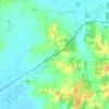
Mount Vernon topographic map

Click on the map to display elevation.

About this map

Name: Mount Vernon topographic map, elevation, terrain.

Location: Mount Vernon, Posey County, Indiana, United States (37.92319 -87.92754 37.95104 -87.85067)

Average elevation: 120 m

Minimum elevation: 100 m

Maximum elevation: 150 m

Other topographic maps

Click on a map to view its topography, its elevation and its terrain.
Caborn

United States > Indiana > Posey County

Average elevation: 126 m

New Harmony

United States > Indiana > Posey County > New Harmony

Average elevation: 121 m

Gear up for your next adventure:

🧥Softshell Jacket - Windproof and breathable jacket for hiking
⛺Bushcraft Tarp - Versatile emergency shelter or gear protection
🔋Emergency Crank Radio - Weather alerts and power without needing batteries
🧤Rechargeable Heated Gloves - Extreme warmth for Canadian winter expeditions
🕯️Camping Lantern - Illuminates your entire campsite with high-efficiency LEDs

As an Amazon Associate, this site earns from qualifying purchases at no extra cost to you.