
Make a donation
Gear up for your next adventure:
As an Amazon Associate, this site earns from qualifying purchases at no extra cost to you.
Osterberg topographic map
Click on the map to display elevation.
Make a donation
Gear up for your next adventure:
As an Amazon Associate, this site earns from qualifying purchases at no extra cost to you.
Osterberg
Ahrberger Holz/Groß Förster Holz | Alter Schlosspark Wrisbergholzen | Amphibienbiotope an der Hohen Warte | Amphibienbiotope Doberg und Weenzer Bruch | Bockenemer Klärteiche | Delligser Steinbruch | Duinger Wald | Entenfang | Giesener Wald | Halbtrockenrasen bei Irmenseul | Haseder Busch | Heberberg | Ithwiesen | Karlsberg | Leineaue zwischen Gronau und Burgstemmen | Leineaue zwischen Hannover und Ruthe | Leineaue zwischen Ruthe und Koldingen | Lieth | Mittleres Innerstetal mit Kanstein | Osterberg | Schiefer Holzer Berg | Schwarze Heide | Selterklippen | Steinberg bei Wesseln | Trockenlebensräume – Sieben Berge, Vorberge | Unterer Lauensberg | Wätzumer Tonkuhle | Wehmholz | Wernershöhe
Make a donation
Gear up for your next adventure:
As an Amazon Associate, this site earns from qualifying purchases at no extra cost to you.
About this map
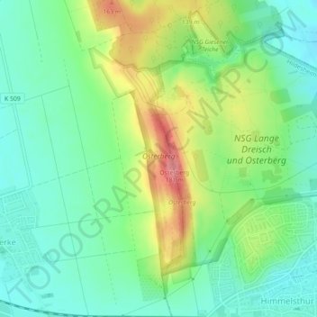
Name: Osterberg topographic map, elevation, terrain.
Average elevation: 111 m
Minimum elevation: 77 m
Maximum elevation: 174 m
Make a donation
Gear up for your next adventure:
As an Amazon Associate, this site earns from qualifying purchases at no extra cost to you.
Other topographic maps
Click on a map to view its topography, its elevation and its terrain.
Sorsum
Deutschland > Niedersachsen > Landkreis Hildesheim > Hildesheim
Stadtmitte und Neustadt | Marienburger Höhe mit Galgenberg | Moritzberg | Nordstadt mit Steuerwald | Oststadt
Average elevation: 164 m
Make a donation
Gear up for your next adventure:
As an Amazon Associate, this site earns from qualifying purchases at no extra cost to you.