Geolocate

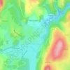
L'Echallier topographic map

Click on the map to display elevation.

About this map

Name: L'Echallier topographic map, elevation, terrain.

Location: L'Echallier, Saint-Dier-d'Auvergne, Clermont-Ferrand, Puy-de-Dôme, Auvergne-Rhône-Alpes, France métropolitaine, 63520, France (45.67451 3.45716 45.71451 3.49716)

Average elevation: 517 m

Minimum elevation: 417 m

Maximum elevation: 614 m

Other topographic maps

Click on a map to view its topography, its elevation and its terrain.
Gear up for your next adventure:

🧢Hiking Sun Hat - Wide-brimmed protection for exposed mountain ridges
🧤Insulated Winter Gloves - Heavy-duty protection for sub-zero Canadian adventures
⛺Backpacking Tent - Lightweight tent for long-distance hiking trips
⛺Lightweight Camping Tent - Portable shelter optimized for Canadian backcountry camping
🛶Kayak Dry Bag - Waterproof storage for kayaking adventures

As an Amazon Associate, this site earns from qualifying purchases at no extra cost to you.