Geolocate

Colpalombo topographic map

Click on the map to display elevation.

About this map

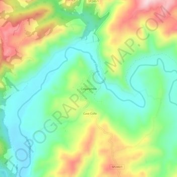
Name: Colpalombo topographic map, elevation, terrain.

Location: Colpalombo, Gubbio, Perugia, Umbria, 06024, Italy (43.22903 12.59407 43.26903 12.63407)

Average elevation: 410 m

Minimum elevation: 287 m

Maximum elevation: 613 m

Gear up for your next adventure:

🥾Approach Boots - Comfortable boots for hiking and climbing approaches
🥾Trail Hiking Shoes - Durable shoes designed for rugged trails
🥽Outdoor Goggles - Protective eyewear for outdoor activities
🧢Beanie Hat - Keep your head warm in cold weather
🧦Hiking Liner Socks - Thin base layer to prevent friction and blisters

As an Amazon Associate, this site earns from qualifying purchases at no extra cost to you.