Geolocate

Plan topographic map

Click on the map to display elevation.

About this map

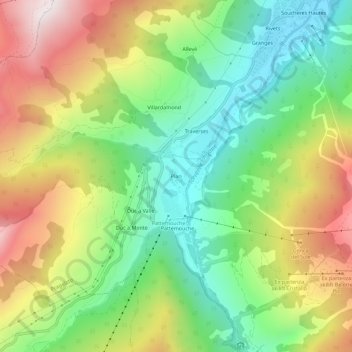
Name: Plan topographic map, elevation, terrain.

Location: Plan, Pragelato, Torino, Piedmont, Italy (44.97268 6.89947 45.01268 6.93947)

Average elevation: 1,908 m

Minimum elevation: 1,517 m

Maximum elevation: 2,465 m

Gear up for your next adventure:

🧦Crew Hiking Socks - Comfortable socks for long-distance hikes
🥾Mountain Hiking Boots - High-traction boots for rocky terrain
🥾Lightweight Hiking Boots - Boots for comfort and mobility on long hikes
🥾Waterproof Hiking Boots - Essential footwear for rugged terrain and wet Canadian trails
🧥Ultralight Puffy Jacket - Maximum warmth that packs down to the size of an orange

As an Amazon Associate, this site earns from qualifying purchases at no extra cost to you.