
Thank you for supporting this site ❤️
Make a donation
Make a donation
Gear up for your next adventure:
As an Amazon Associate, this site earns from qualifying purchases at no extra cost to you.
Nortonville topographic map
Click on the map to display elevation.
Thank you for supporting this site ❤️
Make a donation
Make a donation
Gear up for your next adventure:
As an Amazon Associate, this site earns from qualifying purchases at no extra cost to you.
About this map
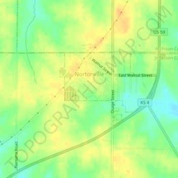
Name: Nortonville topographic map, elevation, terrain.
Location: Nortonville, Jefferson County, Kansas, 66060, United States (39.40881 -95.33936 39.41996 -95.32033)
Average elevation: 348 m
Minimum elevation: 331 m
Maximum elevation: 360 m
Thank you for supporting this site ❤️
Make a donation
Make a donation
Gear up for your next adventure:
As an Amazon Associate, this site earns from qualifying purchases at no extra cost to you.
Other topographic maps
Click on a map to view its topography, its elevation and its terrain.
Valley Falls
United States > Kansas > Jefferson County > Valley Falls > Valley Falls
Average elevation: 296 m