
Thank you for supporting this site ❤️
Make a donation
Make a donation
Gear up for your next adventure:
As an Amazon Associate, this site earns from qualifying purchases at no extra cost to you.
Codogna topographic map
Click on the map to display elevation.
Thank you for supporting this site ❤️
Make a donation
Make a donation
Gear up for your next adventure:
As an Amazon Associate, this site earns from qualifying purchases at no extra cost to you.
About this map
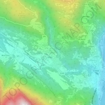
Name: Codogna topographic map, elevation, terrain.
Location: Codogna, Grandola ed Uniti, Como, Lombardia, 22010, Italia (46.01030 9.18967 46.05030 9.22967)
Average elevation: 546 m
Minimum elevation: 192 m
Maximum elevation: 1,406 m
Thank you for supporting this site ❤️
Make a donation
Make a donation
Gear up for your next adventure:
As an Amazon Associate, this site earns from qualifying purchases at no extra cost to you.