Geolocate

Jablance topographic map

Click on the map to display elevation.

About this map

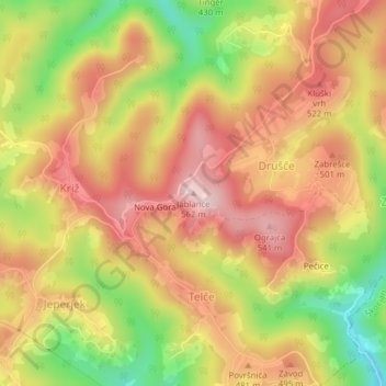
Name: Jablance topographic map, elevation, terrain.

Location: Jablance, Sevnica, 8294, Slovenia (45.96578 15.26011 45.96588 15.26021)

Average elevation: 437 m

Minimum elevation: 268 m

Maximum elevation: 560 m

Gear up for your next adventure:

🛶Canoe Life Vest - Safety vest for water sports
🛶Waterproof Dry Bags - Keep electronics and clothes dry during river crossings
🧤Thermal Hiking Gloves - Grip-enhanced gloves for cold-weather altitude trekking
🧤Insulated Winter Gloves - Heavy-duty protection for sub-zero Canadian adventures
🧦Hiking Liner Socks - Thin base layer to prevent friction and blisters

As an Amazon Associate, this site earns from qualifying purchases at no extra cost to you.