Geolocate

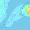
Maasin topographic map

Click on the map to display elevation.

About this map

Name: Maasin topographic map, elevation, terrain.

Location: Maasin, Zamboanga City, Zamboanga Peninsula, 7000, Philippines (6.95116 121.98622 6.99116 122.02622)

Average elevation: 259 m

Minimum elevation: 21 m

Maximum elevation: 601 m

Other topographic maps

Click on a map to view its topography, its elevation and its terrain.

Sacol Island

Philippines > Zamboanga City

Average elevation: 6 m

Vitali River

Philippines > Zamboanga City > Mangusu

Average elevation: 27 m

Sinunug Island

Philippines > Zamboanga City

Average elevation: 0 m

Plaza Pershing

Philippines > Zamboanga City

Average elevation: 4 m

Gear up for your next adventure:

🥾Hiking Gaiters - Protect legs and shoes from mud, snow, and debris
🔦LED Flashlight - Powerful and long-lasting flashlight for camping and emergencies
🔭Compact Binoculars - Lightweight optics for scouting trails and wildlife
🥾Mountain Hiking Boots - High-traction boots for rocky terrain
🥾Trail Hiking Socks - Comfortable socks to prevent blisters and fatigue

As an Amazon Associate, this site earns from qualifying purchases at no extra cost to you.